Trek to Harishchandragad From Mumbai and Pune
This fort is very ancient. Remains of a subtle man have been found here. Various Puranas (Harishchandragad) like Matsya Purana, Agni Purana, and Skanda Purana contains many references. The origins of the Kalachuri dynasty date back to the 6th century. Forts were built during this period. A variety of caves have been carved in the 11th century. These caves have idols of Lord Vishnu. Although the rocks are called Tarmati and Rohidas, they are not related to Ayodhya. The great Chan Shi Changdev (who created the Tattvasara epic) used to meditate here in the 14th century. The caves are from the same period. The various constructions on the fort and the extensive culture of the surrounding area indicate its existence. The idols carved in the Hareshchandreshwar temple and in the Kedareshwar cave in the Nageshwar (Khireshwar village) temple and in the Kedareshwar cave indicate that it belongs to the medieval period as Mahadev Koli belongs to this group as Mahadev. They were controlling the fort before the Mughals. Later this fort was in the possession of Mughals. It was captured by the Maratha’s in 1747.
ROUTES TO HARISHCHANDRAGAD
Harishchandragad is accessible from Thane, Pune, and Ahmednagar. Harishchandragad fort can be reached from different places in different ways. Below are travel routes from different cities.
HOW TO REACH HARISHCHANDRAGAD FROM MUMBAI
1) Khireshwar (Tolar Khind, Rajmarga)
Mumbai – Kalyan – Khubi phata – Khireshwar
- Catch a local going towards Kalyan (on Central Line). Get down at Kalyan Station.
- The ST depot is just beside the station on the west side. Catch any ST going towards Alephata (strictly going via Malshej Ghat)
- Ask the ST conductor for a ticket of Khubi Phata. Khubi Phata is just 5 mins after the Malshej Ghat ends.
- Get down at Khubi Phata and start walking on the 6 km long dam that just starts beside the road.
- Lucky you, if you get a jeep or something, or just keep walking (a good warmup :p ) Once you reach the base village Khireshwar, the actual trek for Harishchandragad starts !!!
2) Belpada (Nalichi vaat, Rajmarga, Sadhleghat)
Mumbai – Kalyan – Savarne – Belpada
Mind it, this is a very tough route and not at all recommended for freshers!
- Follow the previous (via Khireshwar) instructions until point number 2.
- Ask the ST conductor for a ticket of Savarne. Savarne comes just before the start of Malshej Ghat.
- The straight 1-hour walk from Savarne takes you to the base village Belpada (now Walivare)
- From Belpada, the trek to Harishchandragad via Nalichi vaat or Rajmarga or Sadhleghat begins!
HOW TO REACH HARISHCHANDRAGAD FROM PUNE
- Catch an ST from Pune towards Alephata.
- Get down at Alephata & catch another ST moving for Kalyan (strictly going via Malshej Ghat).
- To trek Harishchandragad via Tolar Khind (Khireshwar), get down at Khubi Phata comes just before the Malshej Ghat.
- To trek Harishchandragad via Nalchi Vaat, Rajmarga or Sadhleghat, get down at Savarne. Savarne arrives just after the end of Malshej Ghat
Below is the brief description, easy to understand
Pune – Ale phata – Khubi phata – Khireshwar
Pune – Ale phata – Savarne – Belpada
HARISHCHANDRAGAD VIA PACHNAI
One has to board the bus for Nasik or Mumbai & alight at Ghoti village. From Ghoti, we have to board another bus to Sangamner via Malegaon & alight at Rajur village. From here, 2 ways diverge to the fort.
- From Rajur, one has to board the bus or a private vehicle to the village of Pachanai. From here, the way is straight to the topmost point.
- Recently, the way from Rajur to Tolar Khind has been made available. From Tolar Khind (Tolar valley), the temple is about 2-3 hours by walking.
Reaching Pachnai from Mumbai is fairly difficult as one has to change several buses and loses a lot of time in transit. If one is approaching from Pune/ Nashik, one can reach Pachnai from either Rajur, Kotul, Akole, or Sangamner.
Following are the five trek routes to Harishchandragad
Route 1: Tolar Khind
After getting down at Khubi phata, one has to take a 4-5 km walk on the wall of the dam called the Khireshwar dam. The dam ends at Khireshwar village, and from here onwards a straight route trail goes towards Tolar khind. Around 2-2.5 hours are required to reach till Tolar khind from Khireshwar village. The end of the khind has a stone carving of a lion, symbolizing that it is protecting the pass. After the khind, is a 100 feet rock patch, which has iron railings for the safety of trekkers. There is no need for any kind of special trekking gear at all like ropes, etc to climb it. The climb on the rock patch then leads a straight way to Harishchandreshwar temple, with small hills & streams in between.
Route 2: Nalichi Vaat
Nalichi vaat is the most difficult route to Harishchandragad. One has to start from the Belpada village and begin the climb parallel to the huge Konkan Kada. To the left of Konkan Kada are 3-4 channels that come down from the top. The channel to the extreme right is the Nalichi vaat.
Route 3 : Rajmarga
Rajmarga, which is currently in bad condition, was the main route to ascend Harishchandragad a long back . This road goes the same way near Khireshwar village. From here, instead of going to Tolar Khind, take a straight path and climb up the slopes of Kalshya dongar a Mountain (ask any villager to go Kalshya dongar). The cliff that comes after the Kalshya dongar should be climbed. The climb has rock crumbling and plenty of scree with dangerous patches in between. After these difficult climbs, a Tolar khind joins the path after a rock patch.
Route 4: Sadhle Ghat
The Sadhle ghat is down the steps from the fort to the base. To reach Harishchandragad by this route, one has to go directly to Kelewadi through Belpada instead of going to Konkan Kada . From Kelewadi village, one can climb up the steep slope of the Sadhle ghat. Instead of ascending from Harishchandragad via Sadhle Ghat.
Route 5: Pachnai
Pachnai is the easiest way to Harishchandragad and is recommended for anyone of any age. It takes about 2-3 hours to reach Harishchandragad from Pachnai village. Guidance is available in Pachnai village if required.
FASCINATING SPOTS
Saptatirtha Pushkarni
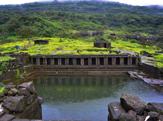
On the east side of the temple is a lake called Saptatirtha Pushkarni. There are 14 temple-like structures on the bank with the idols of Lord Vishnu. However, these idols have now been moved to the caves along with the Harishchandreshwar temple. Some stupid and irresponsible trekkers are cleaning the lake by throwing plastic waste and other belongings. The water was drinkable a few years ago and now you can’t even think of swimming in it.
Kedareshwar Cave
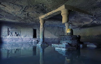
Walking parallel to the side of the temple, at some distance there is a huge cave known as Kedareshwar Caves. Inside the cave is a large Shivling about a foot high, completely surrounded by water. During the rainy season, a huge stream of water flows out of the cave, making it very difficult to enter the cave. Plus the water in the cave is ice cold!
Harishchandreshwar Temple
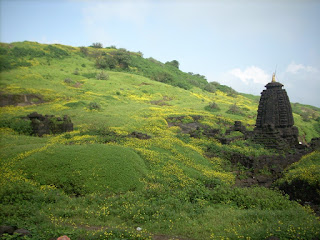
This temple is a sculptural sculpture and represents the medieval temples of ancient India. The temple is about 16 meters high from its base. There are some caves and water tanks around this temple. The river Mangal Ganga is said to have originated from these water tanks. There are three main caves near the temple. Tanks near the temple provide drinking water. A short distance away is another temple called Kashitirtha. The attraction of this temple is that it is carved out of a huge stone. There are entrances on all four sides. These are the faces of the temple guards. To the left of the entrance is the Devnagri inscription about Saint Changdev.
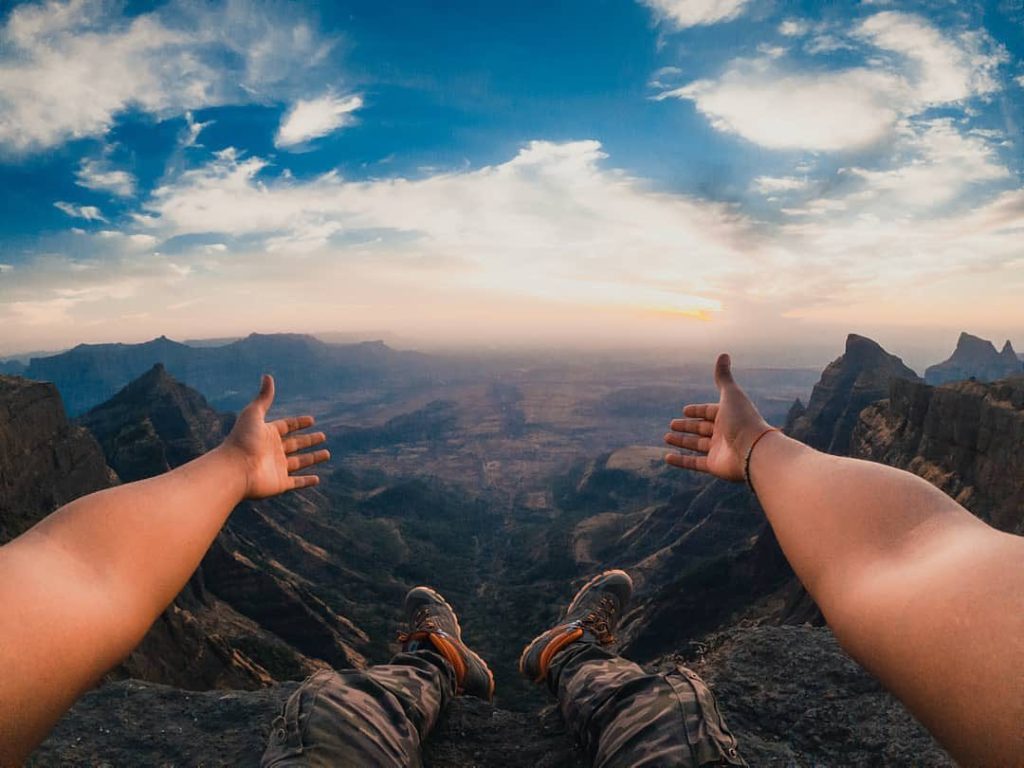
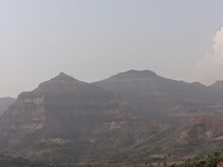
Konkan Kada
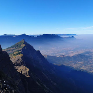
Well, this is an interesting place that a lot of trekkers come here. This hill is seen towards the west and down in Konkan. The height of Konkan kada is about 4000 meters. It’s overhang like a cobra’s hood. When the fog in the valley subsides and the sun is behind the man behind the valley, a circular rainbow may appear. One of the phenomena that can be seen at this place is the explosion of vertical clouds, in which if the clouds are pressed near the heights at the bottom of the pit, they are standing in the sky more than 50 feet (15 meters). This creates a magical wall that rises straight up the cliff without entering the landmass area.
Taramati Peak
Being the highest peak in Maharashtra, it is the highest peak on the fort (1429 m) and is also known as Taramanchi. Many forts like Naleghat, Siddhagad, Ajoba, Kulang forts can be seen from this peak. Many people have seen leopards in the forest beyond this peak.
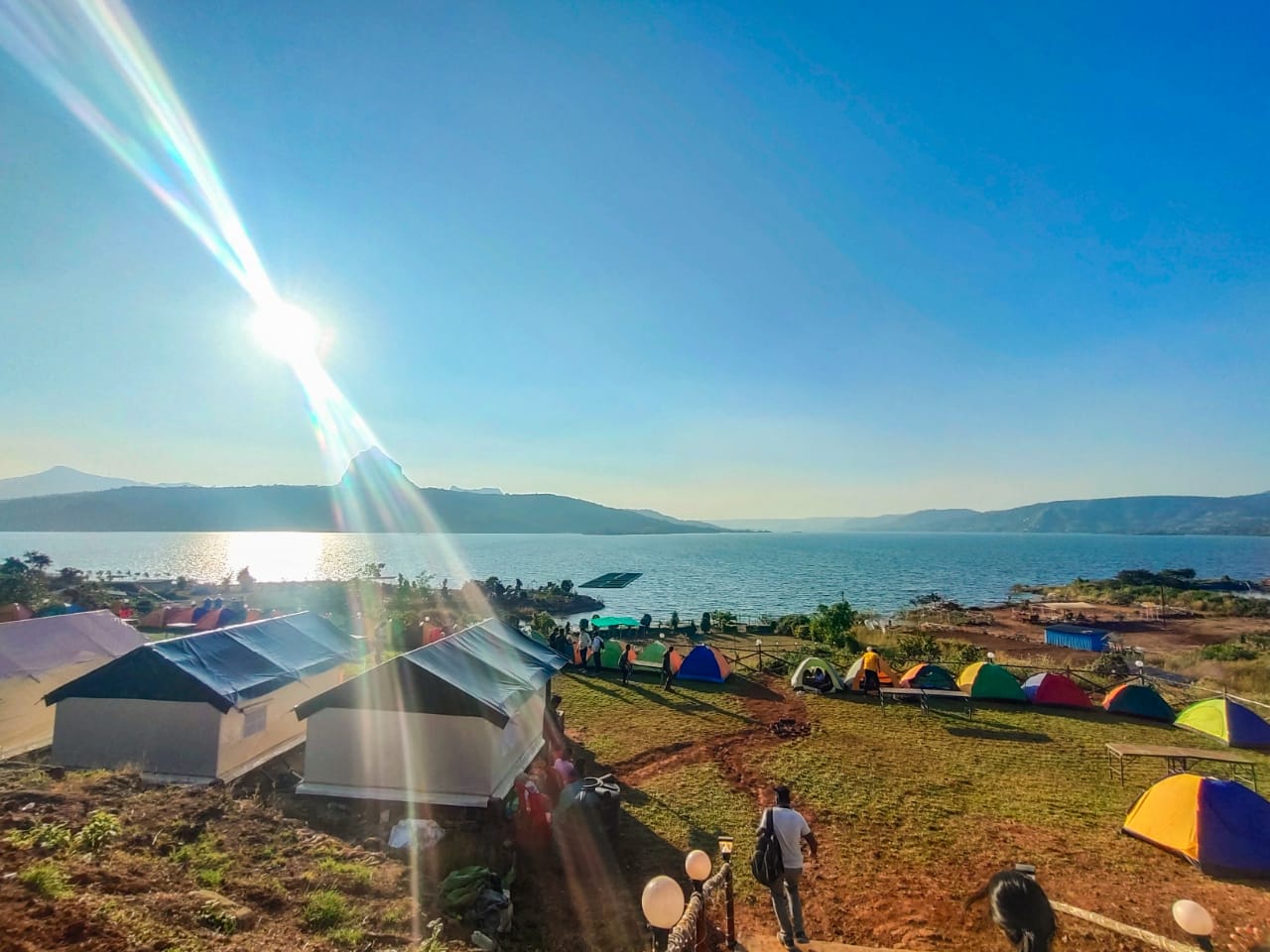
Food and Stay
Some villagers from Paachnai village arrange food and tents on the top of the fort. Meals include bhakri, bhaaji, daal, bhat, etc. along as Kanda bhaji, pohe, tea, etc. They stay in two caves near the Harishchandeshwar temple.
You can spend the night near the temple and in the 9-10 caves nearby. Ganesh Cave is the largest cave and can accommodate about 30-35 people.
Drinking-Water
Water tanks near the caves provide water all year round for basic needs. The perennial stream near the cave is a major source of drinking water. Avoid drinking water on the tank near the caves. During the rainy season, there are numerous waterfalls around the caves that provide potable water. Drinking water is available from the tanks present in the temple compound.
On summer and winter weekends, villagers sell lemon water and buttermilk at two to three points between Tolar Pass and Harishchandreshwar. The basic meal is available at 7-8 temporary shakes during the weekend. Locals can also provide tents for a living.